I write as we head north-north-west, through the Red Sea, towards our next port.
Our route from Salalah has taken us out to the south, into the recommended route for vessels transiting the Gulf of Aden and then south-west, paralleling the Yemeni coast before turning for the Straits themselves. The recommended route is there for a purpose, not to avoid the conflict in Yemen, but to avoid the scourge of the area, pirate attacks. It was made long ago, during the time when attacks and incidents were many and it’s purpose was to provide a ‘corridor’ though which ships would pass and could be monitored by the navies involved in combating these pariahs of the sea. Although incidents are fewer, it it still used, one can never be sure that they have been eradicated for good.
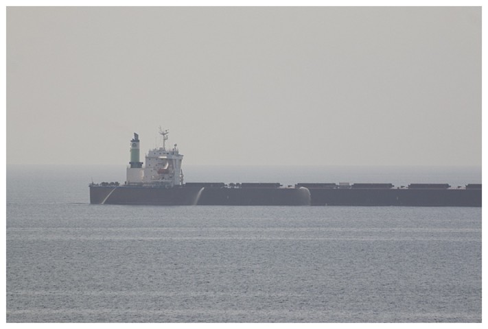
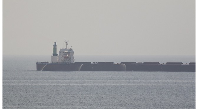
Passing a slow bulk-carrier; she has her fire hoses running as a deterrent. I have seen others, using their ballast tanks, overflowing the side with a waterfall down their entire length. Nowadays many of them carry the best deterrent of all, armed security personnel.
Yesterday involved, of course, our transit of the narrow straits which mark the entrance to the Red Sea. Not only is it an area that has seen a few incidents of ‘suspicious’ activity involving small boats recently, now thrown into the mix is the on-going troubles in Yemen.
As a Master of a vessel with the responsibility for so many people, these pirates and now Yemen only increases the pressure on an already intensive responsibility, particularly when one doesn’t know precisely what the day-to-day situation is. We, (the Carnival Group) have an extremely competent Security division and I had been kept up to date on all the information that they can glean from around the world, so I wasn’t entirely unprepared. News that Aden had been taken by the ‘rebels’ was disconcerting, it is not that far from the Straits and it was the ‘unexpected’ that concerned me more.
We increased speed when we were 2 hours from the Straits, making just over 23 knots, (25 mph, 41 kph.) Additionally, I had the benefit of a 28-knot following wind, resulting in a rough sea, no skiff was going to make a boarding attempt in these seas, unless they were crazy or desperate.
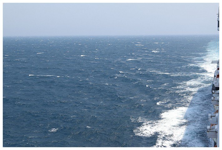
Rough seas make for a relieved Captain
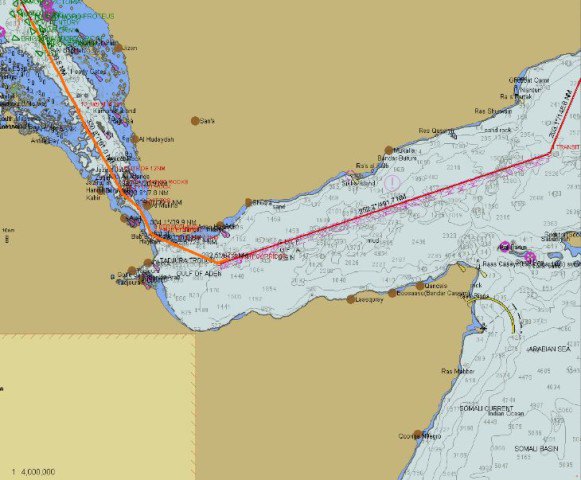
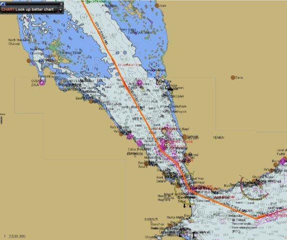
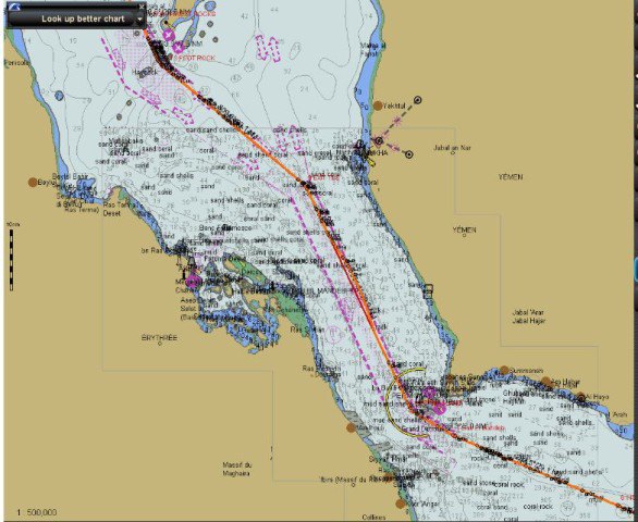
A smaller scale, showing tracks from Salalah to the Red Sea, we cruise 70 miles off the Yemeni coast. *All these ‘charts’ are for your delectation and are not used for navigation.
At 23 knots we are overtaking ships as if they’re standing still and southbound ships fly past us. One, an LPG carrier, is doing almost 20 knots herself, an outstanding speed for such a vessel, our relative passing speed is at 45 knots, almost 50 mph!
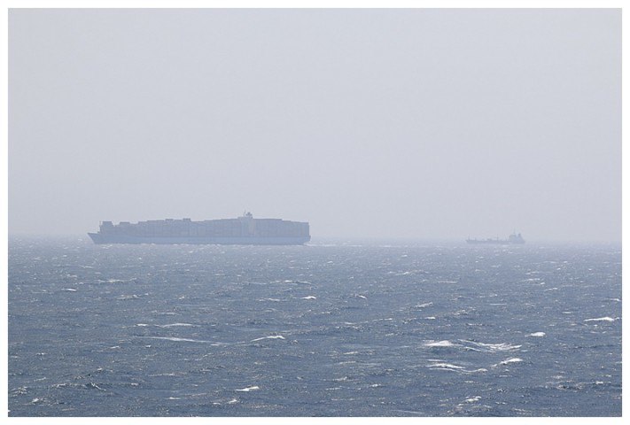
After passing through, a large Maersk-Line container ship and cargo ship, heading south, towards the Straits.
We are flying along and the Straits approach, first of all one sees the high mountain cliff of Yemen and then, the lower areas of the Straits themselves, the Bab-Al-Mandeb, or ‘Gate of Tears’
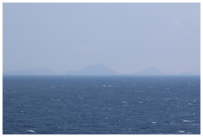
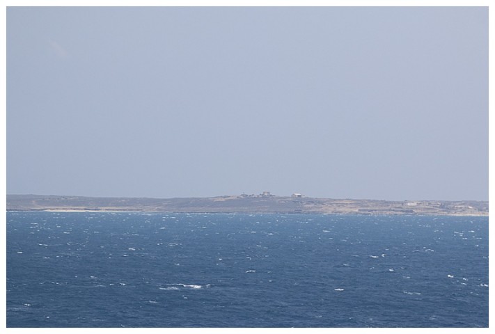
The coast of Yemen, looming out of the heat-haze.
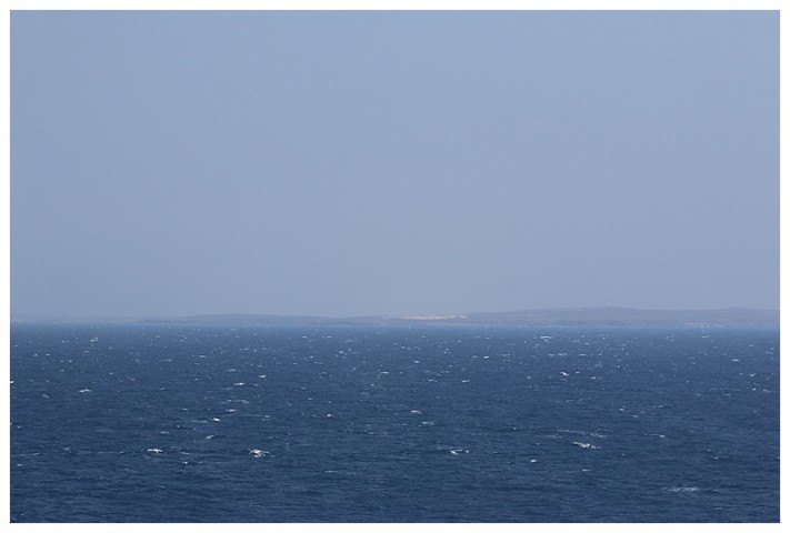
The low-lying western-end of the Yemen coast
Through the Straits
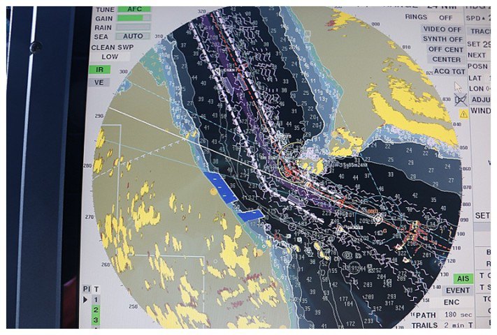
The radar picture, approaching the Straits
We pass 1.7 miles or 1 kilometer off the closest island, though the binoculars one can see no sign of activity, just radar aerials slowly turning on the dull brown buildings on an otherwise drab rocky, sandy coast. This is the closest we will get to Yemen and all I want is to get it astern as fast as possible.
Passing the island with its radars
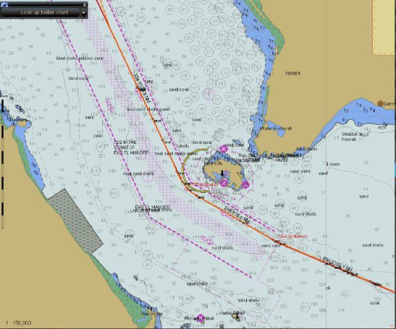
The Straits. Yemen to the north, Somalia and part of Eritrea to the south-west. We pass 1.7 miles of the Yemeni Island
We keep the speed up, although through the gap, we still have Yemen on our starboard side for some time. Being so painstaking about saving fuel, the fact that we have to do this as utterly annoying, a sign of the world in which we live I suppose, however it’s terribly frustrating.
A larger scale of the transit, with the VTS lanes clearly visible.
A helicopter ‘buzzed’ us just before ‘shot the narrows’; Djibouti is not far away and I presume that it is Naval and from one of the Navy ships operating out of there. Later, through the haze, we see a Naval vessel, close inshore off the Yemeni coast, however, because of the haze, it is indistinct. Then later in the afternoon, a southbound Naval vessel, going like a bat out of hell southwards.
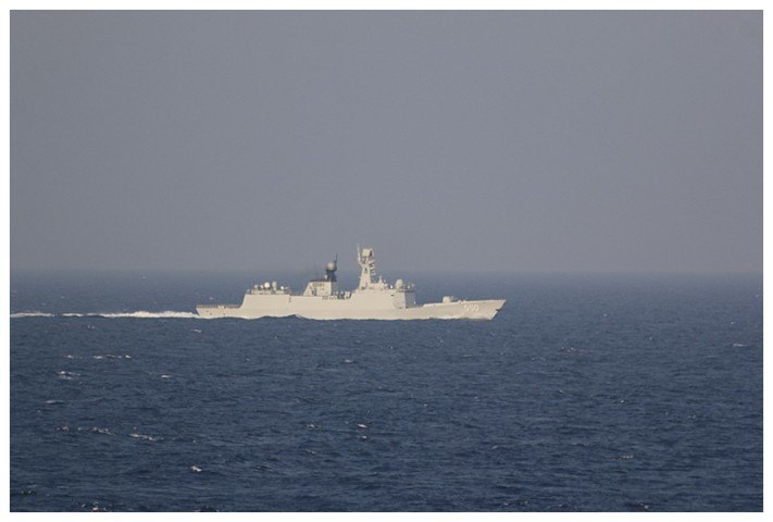
Later in the day, what we believe to be a Saudi frigate, running south at high speed.
*An ‘edit’ on the 1st April. It appears that this vessel was in fact a Chinese frigate, on her way to Yemen to evacuate Chinese Nationals from Yemen.
I write from the relative calm of the Red Sea, we have another 38 hours before we reach our destination. Now I am attending to our Suez transit, they have one-way traffic through there at the moment and the possibility of delays, yet more cunning plans 🙁 called for. Until later…..
