I write at my desk on a baking hot, humid day, a 25 knot wind does little to cool it down. Although the date on the post is 1st February, that is the local time of the web host; it is in fact the 2nd of February here.
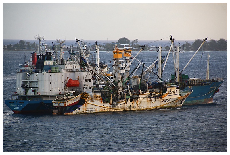
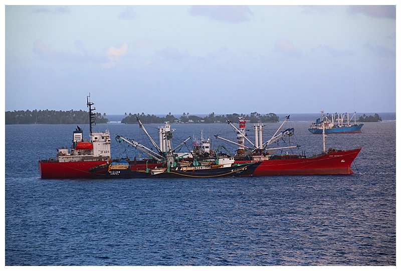
We are docked on a pier which needs some TLC, however at least it’s a dock as opposed to anchoring. There are numerous ships doing that, mostly refrigerated cargo ships, known by sailors as “Reefers”. They are here to load fish and alongside most of them is a fishing boat of some form; some purse-seiners, which use a long net strung out in a ‘loop’ by a small boat that each one carries. Others are Trawlers, these drag a deep net behind them. Tuna is their reason for being here and this is what they load. Some are here for months, waiting to fill their holds, others for a matter of weeks.
A purse-seiner, (badly in need of a coat of paint), unloading fish
…and a Trawler doing the same
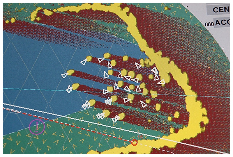
A radar snapshot, with the cargo ships and fishing vessels at anchor.
What fun we had this morning. Approaching in darkness and first light a little later, we made our way towards the only approach through the reefs which surround the large lagoon and on which Majuro lies. The ‘Calinin’ channel is narrow and is meant to be marked with buoys and beacons. As is the norm with most of these islands, the wind and weather sometimes moves, or destroys the marks and today was no exception. Buoys we missing and some expected lights were non-existent.
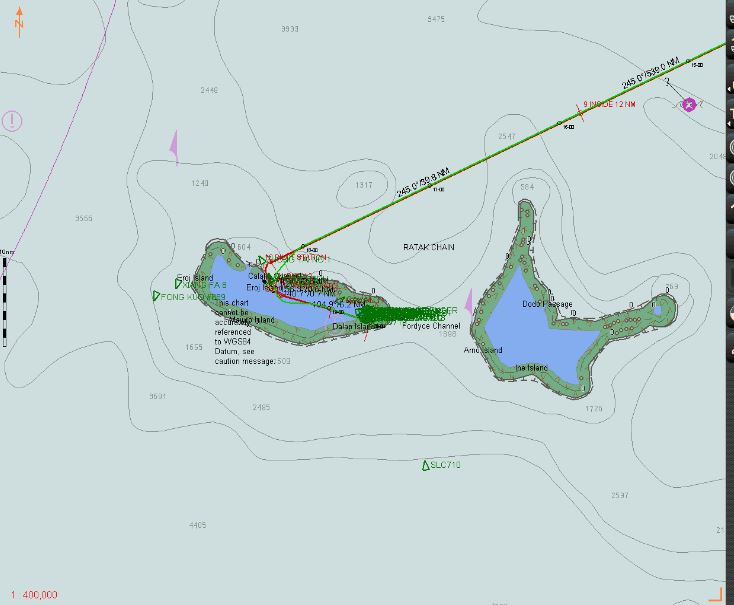
An overview of the approach
We had spent a long time beforehand going through what would be required; a ‘Bridge Resource’ meeting with checklists which covers every eventuality, so we knew exactly what we were doing. Unusually, we could not use Electronic charts and overlays on radar and we navigated with methods from days of old, a paper chart and mark 1 eyeball and it worked like a charm, it brought back old skills and happy memories. We had a pilot, although, once he had his coffee in hand he was content to leave it up to us, just the way we like it 🙂 Taking the channel at enough speed to counter the strong wind on the beam, (which would push us ‘sideways’), we negotiated it and then built up speed, for it is 14 miles from there to the dock, (it’s a big lagoon)!
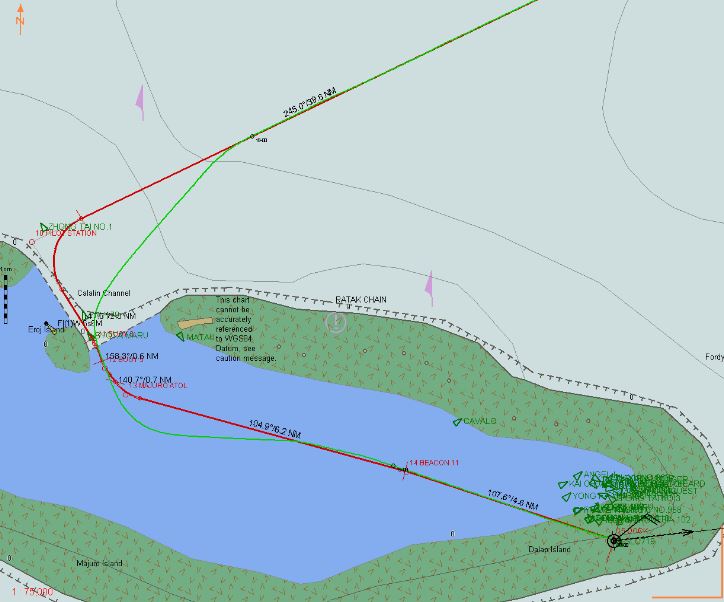
The channel, our track in green. As you can see, the electronic chart has no detail; no buoys, light, depths, nuffink…..
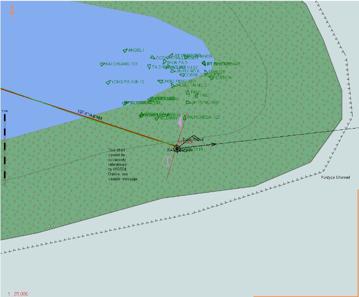
Even worse, according to this electronic chart, the dock lies on a coral reef!! 🙂
Fortunately, the dock heading lies more-or-less on the same heading as the wind, just 15° off, so we didn’t have to fight our way to the berth. All fast and cleared by Immigration and Customs, guests could take the ‘minivan’ shuttles to the town.
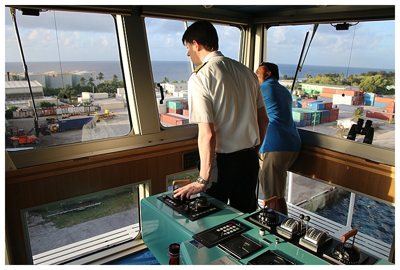
Thomas, taking her alongside, the pilot behind him, relaxing……
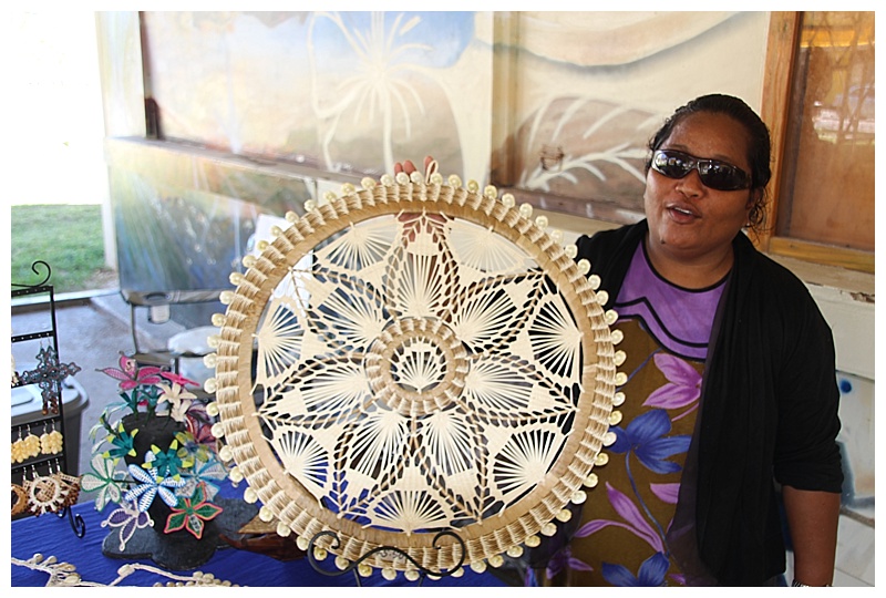
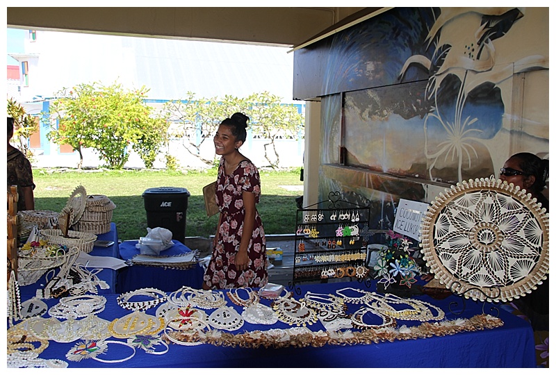
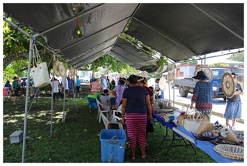
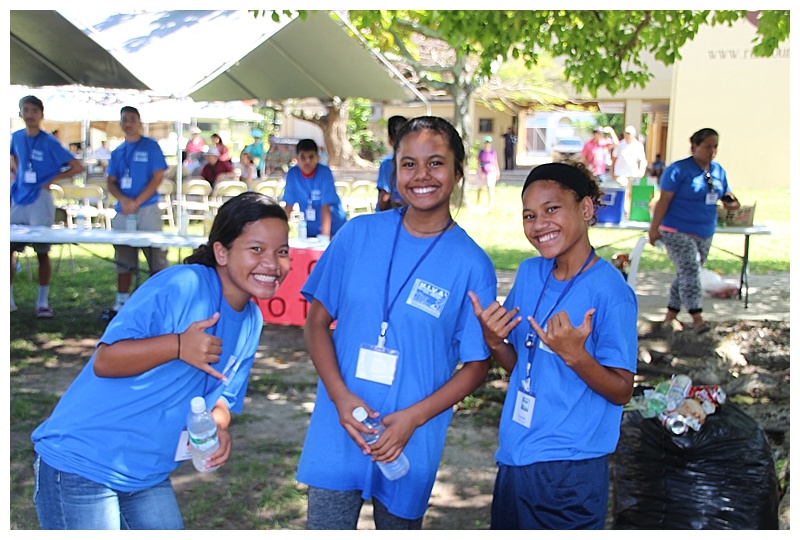
I would use that term loosely, although I didn’t go, I am told that one could miss it if one blinked. Nevertheless, I know guests enjoyed having their feet on dry land for a while and having a wander. Karen and Hazel did so and some of Karen’s photos are posted with mine. They returned with some local trinkets, lovely necklaces and bands which had been hand-made by the local ladies, made from shells and colourful braid.
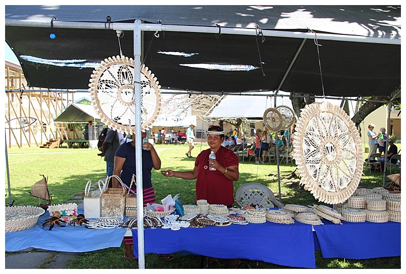
How could I not show you the stalls????
Schoolchildren, on lunch-break
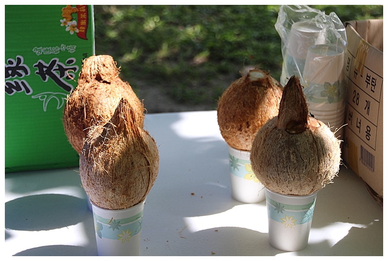
Fresh coconut to quench one’s thirst
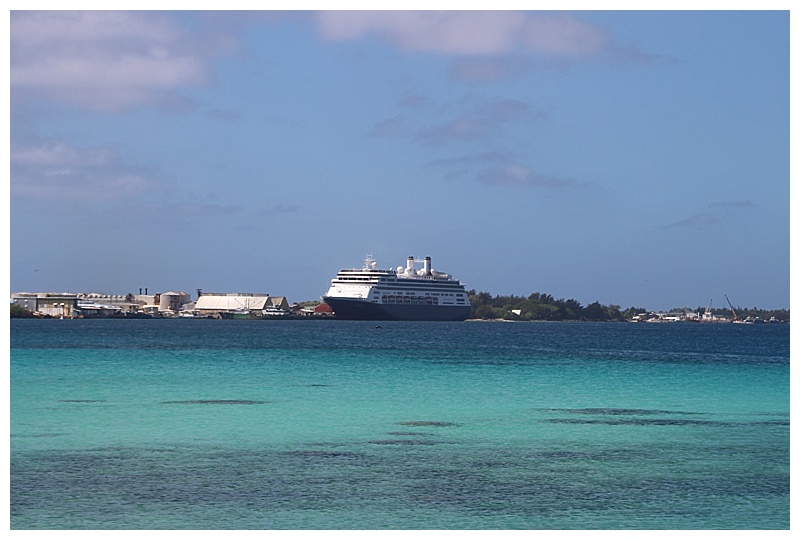
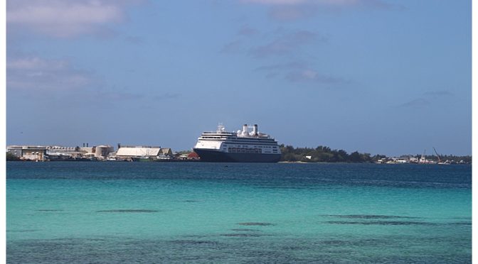
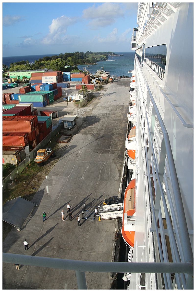
The Amsterdam, from the town.
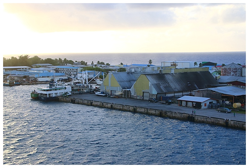
Our dock
 OK, I’m going to try again, a time-lapse video, as we entered, (dark), although one can just make out the reef to starboard (right) if you pause it; then the turn through the channel and the run to the dock. I’ve got it down to 36 seconds, it actually took an hour…….
We leave here later today and another 4 days at sea, heading for Guam. I am a ‘history’ buff and having toured many a European battlefield, I am hoping both Guam and Saipan will have something of interest, although a web search on some of more well-known travel sites has drawn a blank……

Hi Jonathan,
Bravo to all on the sail in and I appreciated the detailed description.
Lovely photos – lovely smiles! Thanks Karen! The video was wonderful. I know how much I enjoyed the sail ins while on board.
Best, Rosie
Time lapse video was marvellous.. enjoying your blog’s ..
Captain Jonathan,
Thanks for your blog and sharing your Go Cam video.
Cheers~
Captain Jonathan,
Great job on the video and on the great job navigating to the dock. Must have been interesting. FYI: Great weather in Cocoa Beach and Merritt Island. We miss the Amsterdam and it’s crew.
Hi Captain; looks like Jeff is on his “normal post” for arrivals’ blo the bridge, camera in hand and baseball hat turned backwards 😉 Pretty sure all the kids in the Pacific know the ‘hang loose’ sign. Safe travels!
Hello Captain
The Marshall Islands were a testing ground for the US nuclear weapon program. From 1946 to 1958, 67 devices were detonated, including high yield fusion types.
Today there are from 2,000 to 6,500 Marshallese living in the island nation of Springdale, Arkansas. They were evacuated when their homes became radioactive. Due to a diplomatic treaty, the Marshallese with a passport are allowed free entry and immigration to the United States.
A large force of American Soldiers went to the Marshalls as the Enewetak Atomic Cleanup Veterans in the late 1970 period. They became known as the Lojwa Animals. Sadly, today they are suffering the effects of working around the irradiated materials.
Today Bikini Atoll remains above accepted levels of radiation. Paradise Lost.
Majuro is considered safe.
Congratulations on your video accomplishment. Wonderful. Looking forward to many more!!!!
Thank you Captain Mercer
Capt.Jonathan.
Thank you for taking us along this voyage.Highly entertaining and equally instructive,
Are you staying at the command until PortEverglades 26th April,or are you continuing until SanDiego following the Transit?
Cheers
Claude
Hello Claude, I disembark on April 26th and return again in Alaska.
Hello Captain Jonathan,
We were on the Amsterdam in October 2013 when Captain Fred was in charge. That Grand Voyage visited Majuro, Chuuk, Guam and Saipan. You have several people on board now who were on that voyage. I’m sure Barbara did the port talks. Henk and Crystal were there. Jeff Farschman has photos of Guam and Saipan starting here http://amazingvoyages2.blogspot.com/2013/10/day-17-guam-part-1-of-2.html
In both Guam and Saipan a group of us did prearranged private tours of WW2 sites around the islands. In Saipan Banzai Cliff is very moving. Many thousands of people jumped to their death as they were scared of the advancing US Marines. There are many memorials and shrines. Nearby is Last Command Post where there are old guns.
I am surprised you arrived at Majuro in the dark. My photos from 2013 show us well away from the lagoon at first light and our docking hours were 11-6 after 4 days at sea from Honolulu.
Too bad you have to miss Chuuk which had very friendly people and a torrential rain storm. In fact Captain Fred had to outrun a typhoon from Saipan to Kobe, so hoping you will have drier weather and calmer seas.
Thanks for writing and for the charts and photos.
Love the time lapse!! Very cool way to see a lot without taking a lot of time; keep ’em coming!
Captain Jonathan,
I always enjoy reading your posts, especially when you visit a port we haven’t been to and today’s port is certainly one of them.
I also enjoy seeing your photos. I know it takes time to do a blog but I and many others do enjoy reading it. Thanks for taking us along with you on this fantastic cruise.
Jennie
Hey Captain,
Noel from Melbourne here including a link to your next ports Guam, Saipan, Iwo Jima etc as sailed on the Statendam Pacific WW2 cruise a few years back. So memorable, with mostly veterans from the battles there in board.
https://youtu.be/6TZlCIsQYHA
I have included Part two which covers these ports
So hope you have some time with ’nuffink’ to do as it runs around 10 mins… that is if you can view on the ships internet
Safe travels
Noel – Melbourne
Hello Noel! Thanks, this marvellous ?