I write from the lovely city of Tauranga, New Zealand. It has been a busy few days, hence this post is encompassing a call to Auckland too. I mentioned in my last post that we were in for a bit of a “blow”, well, we got it, by far the roughest weather we have experienced since leaving Port Everglades. We had a full day of it and it was only as we moved into the relative shelter of the North Island of New Zealand that we saw an easing of wind and sea. Highest recorded gusts were 70 kts, or 77mph, 123 kph. These were gusts, however most of the time the wind was around 50 kts, 55 mph, 88kph. Seas were around 13 feet or 4 meters and it is fortunate that the “Amsterdam” is such a wonderful sea-going ship. She ‘rides’ seas far better than many ships I have sailed on.
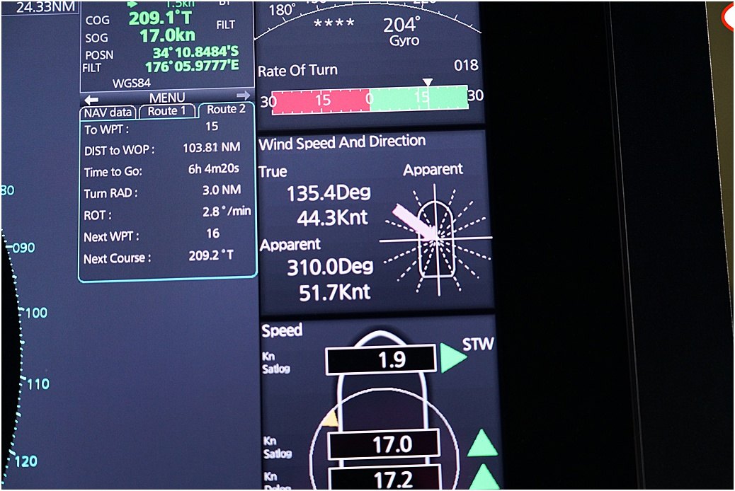
Our anemometer readout
Auckland and I stayed on board, Karen and Hazel were off to tour a local vineyard and partake of some lunch. A one-day stay unusually, (we have had an ‘overnight’ quite often).
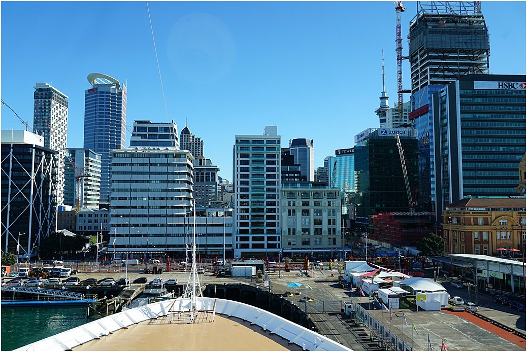
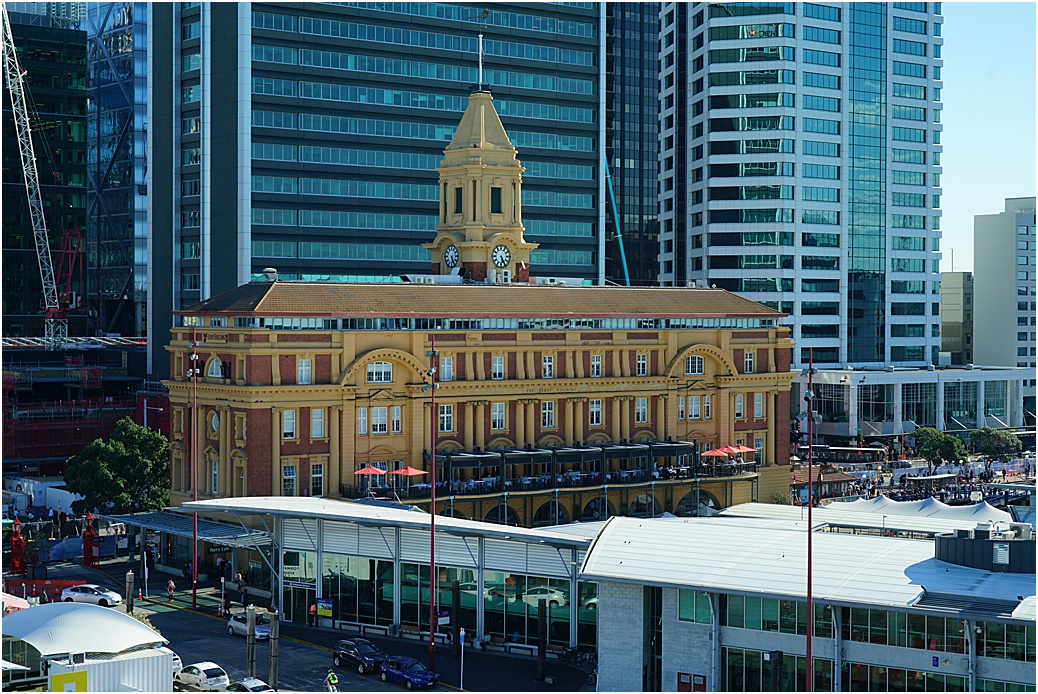
‘Parked’ right in the centre, adjacent to the Ferry terminal…very convenient
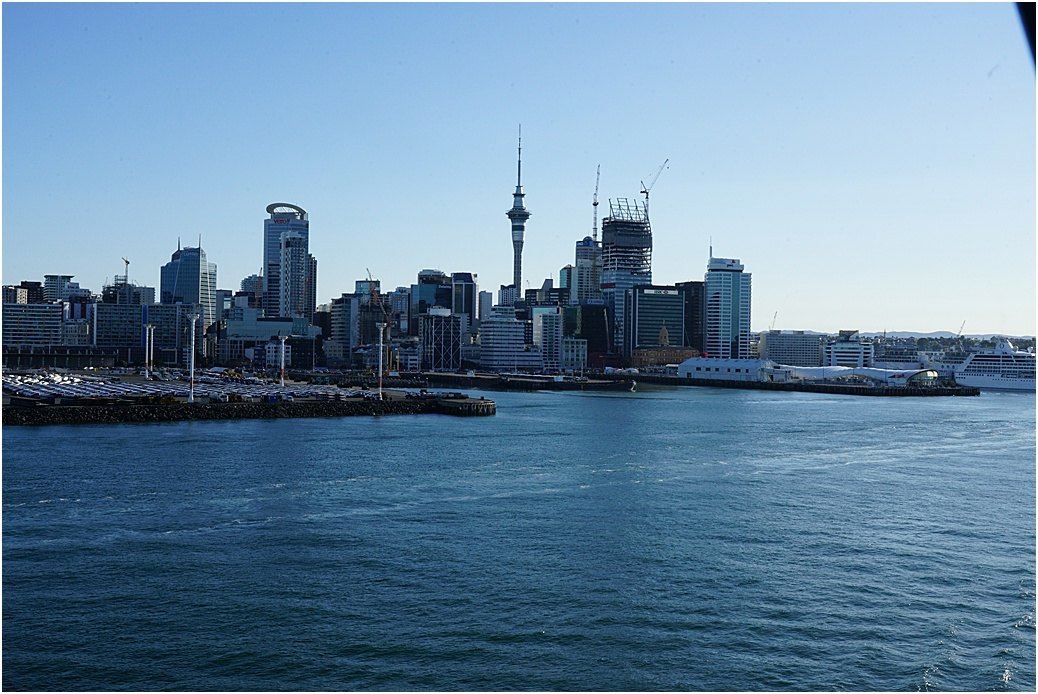
Taken on departure, the skyline of Auckland
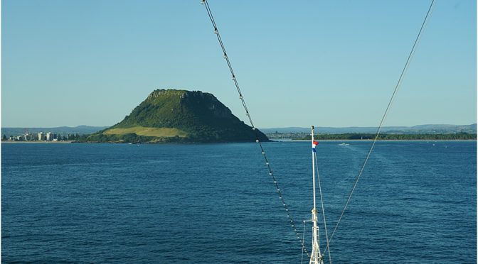
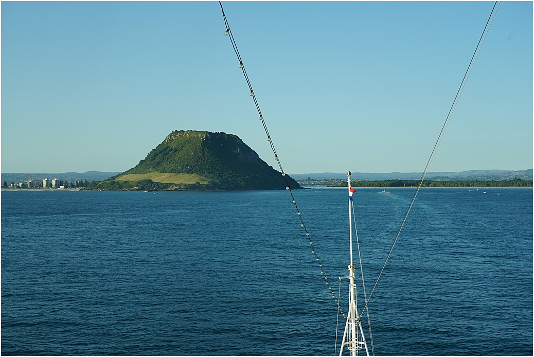
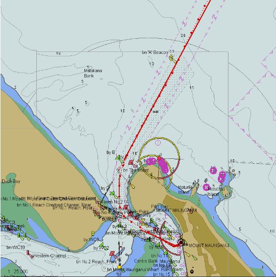
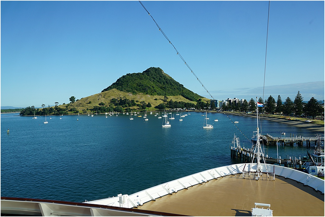
An overnight journey towards our next port, Tauranga, a beautiful city, favoured by many as an ideal place for retirement. The port entrance is dominated by Mount Maunganui, of volcanic origin, it can be seen from miles away when approaching by sea. I am informed that Tauranga in the Maori language equates to “safe place for canoes”
Its deep-water port makes it ideal for larger vessels and it is fast becoming the primary port on North Island.
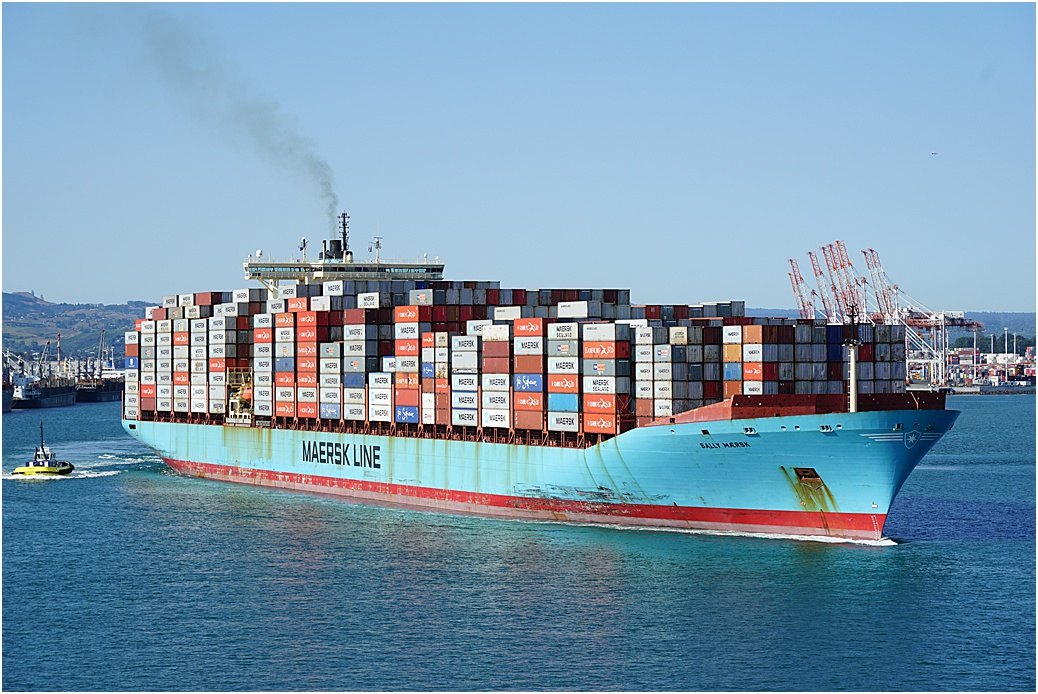
The massive “Sally Maersk” departs Tauranga
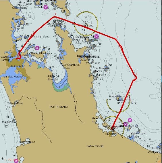
The route from Auckland
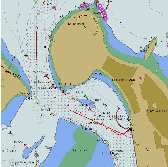
The approach to the port
and the docking itself
The view from the dock
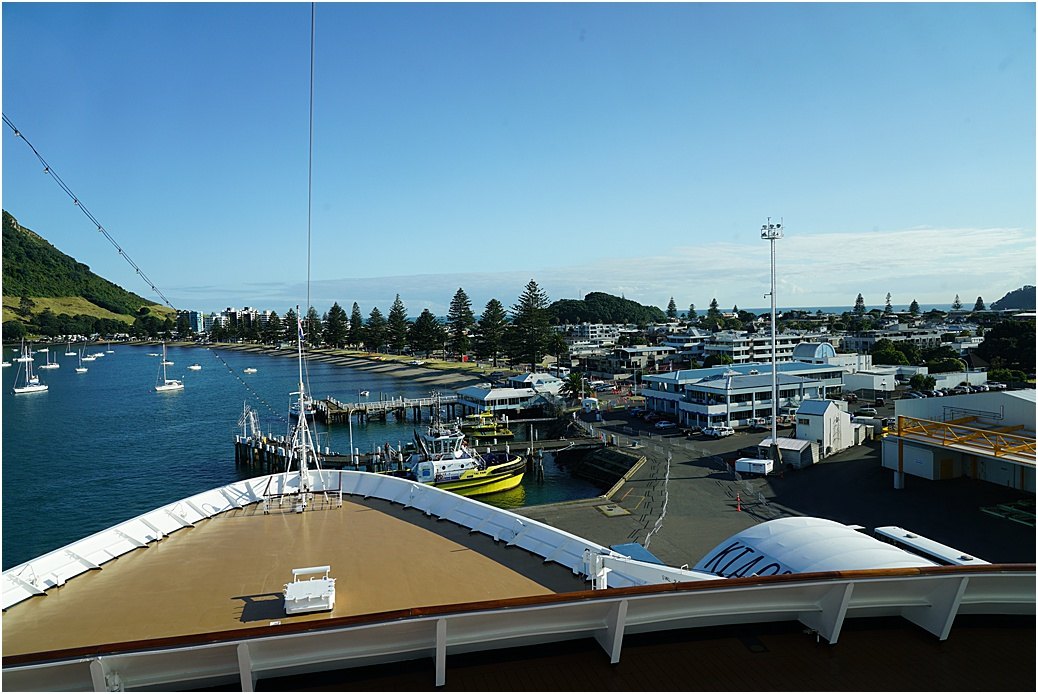
The tug-haven and beachfront
Apart from writing this post and dealing with ‘business’, we also take the time for a voyage overview of the journey to our next port. All officers involved gather on the Bridge and we discuss, in detail, our departure manoeuvre, tides and currents, speeds in the channel and beyond; the route of the voyage (to Wellington) itself, special areas, environmental considerations, a plethora of information, too many really to mention here, however I’m sure you get the picture.
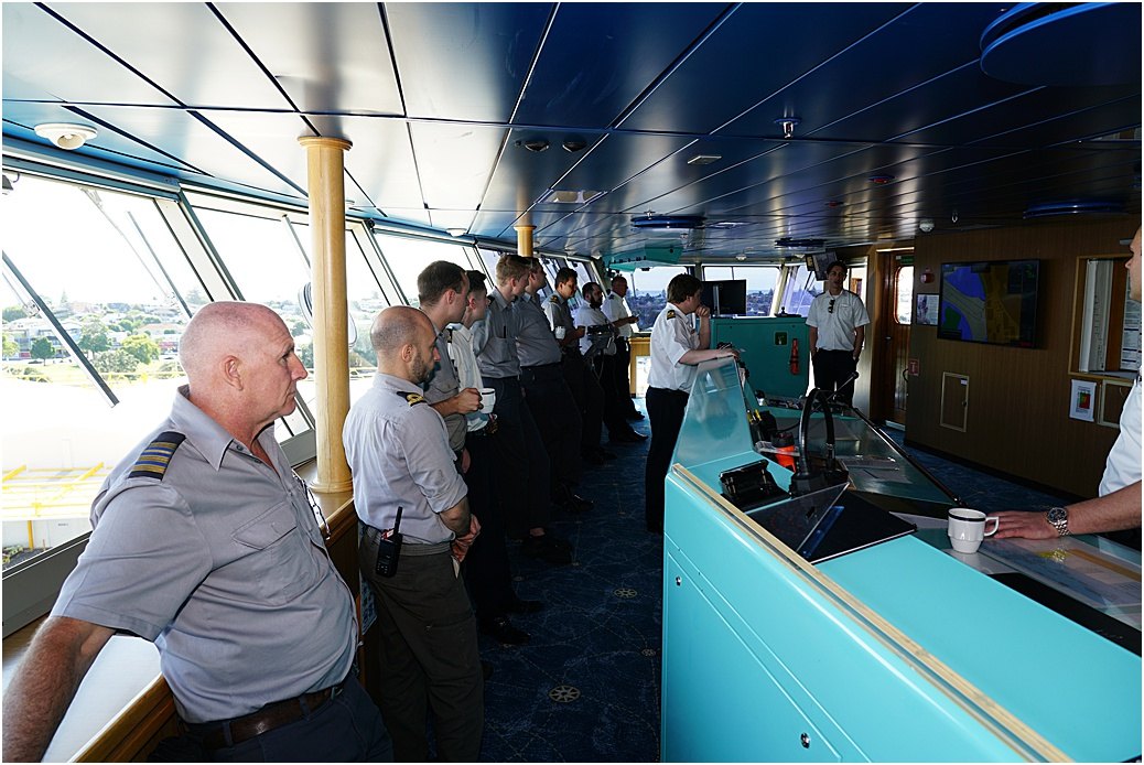
Discussion and overview…..
During our stay, we are ‘bunkering’ fuel. 1,000 metric tons, or around 250,000 Imperial gallons, so don’t take this baby to the shopping mall!
Tauranga has ‘windows’ for arriving and departing vessels. The currents in the harbour can reach up to 5 knots and it would be nigh impossible to safely manoeuvre in these conditions, thus ships enter and leave around a window of ‘change of tide’, as it is less strong at these times. For example, we were scheduled to dock here at 7 a.m. which meant entering the channel at 5:45; because of the current at that time, we were advised by the Port to arrive at 7:30, when the current was slacking off, similarly, the itinerary had us leaving at 7 p.m. Not good…so we are departing at 9 p.m. again for the weaker current….Off to Wellington, New Zealand next 🙂

Another WOW sail in and I would second Leslie’s comments. When watching and reading your blog from home I appreciate even more the skill and knowledge of a captain like you Jonathan to take on the challenges the guide the ship to shore safely. On a fun note I caught dear brother in-law Eddie on your video!
Again thanks for taking the time to post your fabulous blog.
I had it worse but it was on Rotterdam. Mom and I were on the Baltic capitals in August/sept. But the holland website shows it as Greece/turkey cruise for 19 days. We encountered 40 ft sweells for 48 hrs as we left rekavik (sp). Mom and I were staying on the promenade deck of that ship and the waves 🌊 were knocking at our big picture window. The crew and passengers were being thrown around. One passenger I heard got thrown back against one oh those Columns and had to have stitches. Glassware was broken and only 2 elevators worked. The captain was trying desperately to get to the Irish Sea. So we missed Torshavn and the Shetland islands. That was the last time for bridge tours I guess. I did the bridge tour and we could hear alarms going off all over the place. They said Some fishing boat was causing the alarms and if they needed help the Rotterdam was the closest vessel that could render aid.
Before my comment I certainly will second Leslie.
As a woman some of the maneuvering is not that understanding, but I must say since reading all your post over a few years now each cruise I take you are always in my mind and thinking about the Captain who’s ship I’m sailing on, it isn’t always the cabin,food, it is seeing the docking and leaving and knowing by your writing what must be happening on the bridge.
Enjoy all you post and pictures to show. Thank you
Wow, your command of the sea is like your command of the English language……love learning how this all comes together…..As a passenger I assumed with technology being what it is, you push this button etc. never thought you meet and discuss movements, currents etc. . fascinating!!!!!! I hope your wealth of knowledge is being spent wisely on the younger crew members and they become future captains with the same appreciation of Mother Nature, and everything you share with them including your good old fashioned common sense. Again, greatly appreciate your blog Big J and all the great photos…thank you, thank you……”