I write from the Solomon Sea, having rounded the south-east tip of Papua New Guinea during the evening of the 19th and then the Star Passage early this morning.
I am something of a ‘history’ buff and, with the assistance of Barbara, our Travel Guide, who has some wonderful books about the area, I can tell you that we are now in the area of Operation ‘Cartwheel’, a plan, formulated by MacArthur and Nimitz, to exploit recent victories in early 1942. Where we are now would not be a good place to be in July ’42.
As I mentioned briefly in my last post, I cannot but feel admiration for those men of each Naval force, no matter what their nationality. Navigating as we do now, equipped with radar, GPS, electronic charts and heaven knows what else, the passages are complicated and require intricate planning.
To do this, mainly at night and at tremendous speed, possibly engaged in a firefight, with none of the aids we now take for granted, defies logic and the fact that the reefs we pass between are not littered with wrecked warships is a testimony to their skill.
As I mentioned yesterday, I had to stay on the berth at Alotau for an additional hour. Sailing time arrived, however the wind, on our beam, was gusting up to 38 kts, or around 42 mph. I can lift the ‘Amsterdam’ up against a beam wind of 25 kts, just. Any higher and the decision is relatively straightforward, ergo we’re not going anywhere. I spent the time on the Bridge, watching the anemometer (wind gauge) and eventually, after 40 minutes or so, the first decrease became noticeable and by 6 p.m. it was manageable.
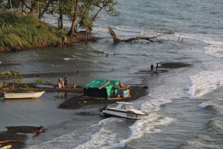
While waiting for this wind, one could not help but notice that on a patch of land close to our bow, lay a ‘squatters’ commune. One house, (I use the term loosely), was on a sandbank, (obviously the inhabitants cared naught for global warming); the shack was wood-frame with a tarpaulin draped across the roof. The wind has caused larger waves to wash up the sandbank and as a consequence, the occupants were bailing out their living space with great alacrity; it provided some humour for a while. We’re terrible aren’t we? No sympathy whatsoever…. 😳
We took our first reef passage at 8:30 p.m., the route is approximately 1/2 a mile wide and 8 miles in length, it is lit by buoys. In the darkness, one couldn’t see much, (except the buoys of course) and an occasional patch of moonlight would reveal waves breaking on the coral.
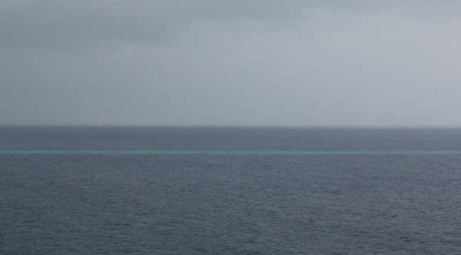
The second Passage, the Star, was done in monsoon-like weather and, unlike the earlier passage, there are no navigational marks or aids; however this was daylight, (well, a grey one) and the turquoise water over the reefs could be clearly seen as we weaved our way north, using GPS and charts, not forgetting Mk 1 eyeball of course 😯
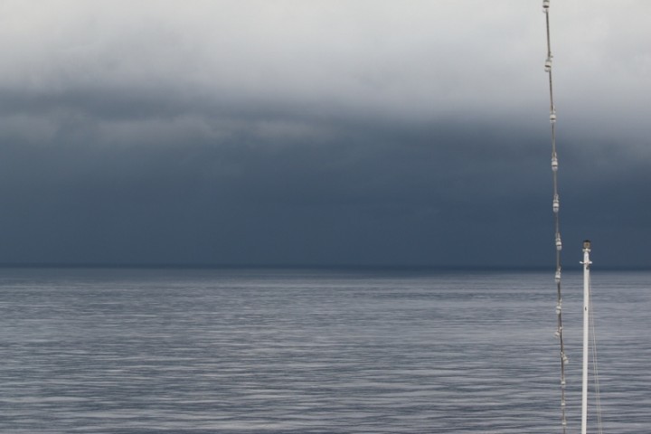
Monsoon squall
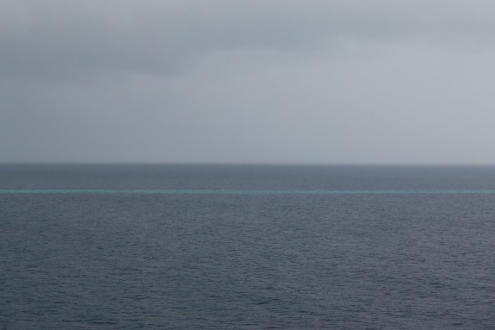
A section of reef on our port side
This evening we progress into the Bismark Sea and thence Madang, once known as the prettiest town in the Pacific, it has, apparently, become somewhat jaded. Tomorrow will tell.
BTW, thank you for all your comments regarding ‘slide show’ or individual photos; the ‘individual’ won, hands down.

Captain Jonathan,
Thanks again for the interesting blog and photos. I too find the history of the area you are sailing quite amazing. Glad to hear Barbara is sailing with you once again. I remember how her information added to our experience with you in 2012.
Regards and Cheers!
Captain:
Thank you for this narrative!!! My father was in NG and the PI during WWII and I always heard it was among the hardest of duties…
(Wife and I sailed with you on the 2012 voyage; have committed to the 2015 World Voyage; and, appreciate all your postings.)
Thank you and best wishes to you, family and shipmates.
David & Ruth Wentzy