As we crossed the Gulf, the expected change of weather occurred; clouds rolled in from the west and the occasional rain shower would fall on our decks. Having left Kodiak we made a speed of 18 kts (about 20 mph), making for a way point off Ocean Cape, the southern entrance to Yakutat Bay.
Having embarked (yet another) pilot off Yakutat itself, we headed north, 16 miles towards Disenchantment Bay and Hubbard glacier. Disenchantment Bay was so named by the Spanish explorer Malaspina who, searching for the North-West Passage and the route to the Indies, sailed up there, only to be confronted by a wall of ice. Obviously disenchanted, he named it so, (Spanish originally of course).
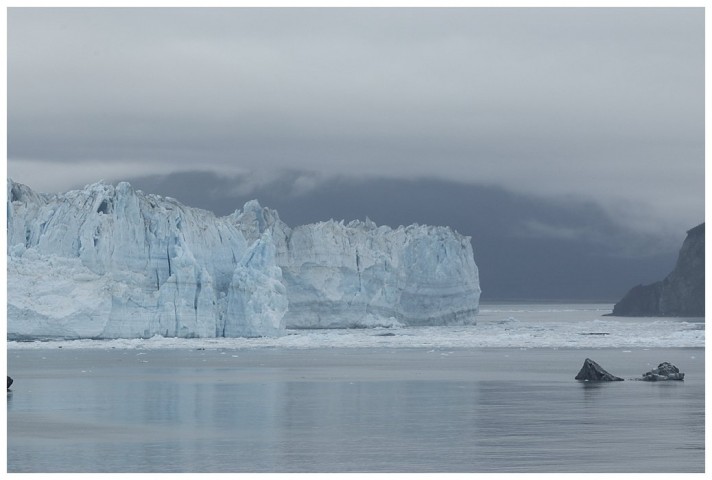
I am far from disenchanted; although hard work, this scenic call is anticipated with relish, beach bear hunts, navigating through ice and then, the largest tidewater glacier in North America; almost 7 miles wide and over 300 feet high, who couldn’t be awed by the majesty of it all.
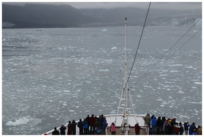
Past Point Latouche and into Disenchantment Bay itself, the mist is lying across the Bay, the clouds low and a drizzle of rain accompanies us. This doesn’t seem to deter our guests, wrapped up in the warm woollies, hats and gloves, they’re out on deck, enjoying their first glimpse of Hubbard and Turner glaciers, visible through the gloom. As often occurs, the mass of glacial ice forms its own ‘mini-climate’, the drizzle stops and the skies brighten a little.
Early in the season, ships can often encounter ice too thick, stretching across the Bay and impenetrable by ship, it’s happened to me, once or twice. This time however, all is well. It’s going to require some nifty ‘weaving and dodging’, however a clear lead off the face can be seen, beckoning us and too tempting to resist. Our intended path suddenly changes, the current is flooding and as a consequence where there was once what seemed a good path through the ice, suddenly closes; another route is quickly chosen and so it goes on.
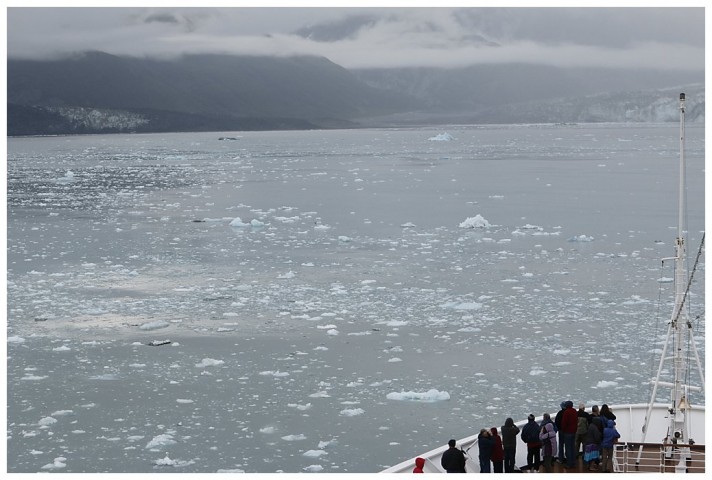
Turner to the left, Hubbard ahead; trying to navigate through the brash ice
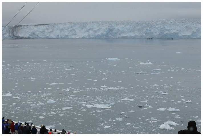
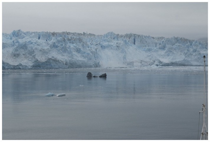
Almost through, clear water ahead
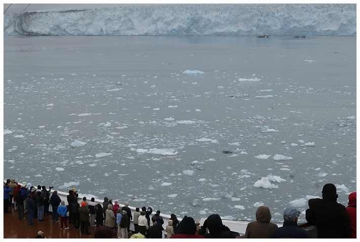
Avoiding the larger chunks
Eventually we make the clear water near the face, having sailed past Turner glacier,(on the west side), we ‘hook’ a right and come in behind the ice. I have to watch it while we hover a ½-mile from the face, making sure it doesn’t close the ship, or more to the point, the props; the larger ‘growlers’ would wreak havoc with our propeller blades. We stay for an hour, listening to the ‘white thunder’. the sound of ice cracking as it moves forward. We have some large calvings and the air is so still that the shouts and cries of delight from our guests, can be clearly heard on the Bridge. Little do they know, we are as excited as they are 😉
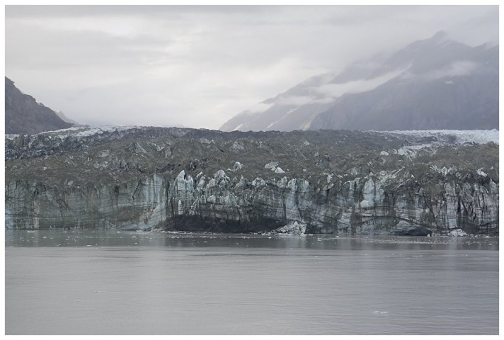
Rock and ice, Turner glacier, Disenchantment Bay
Turner glacier
A calving, a mere 200 tonnes of ice is water-bound
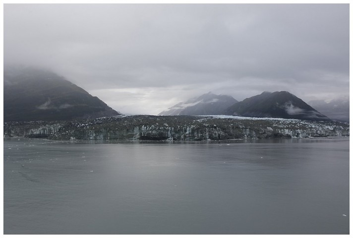
We stay an hour, alternating each side of the ship, so that there is ‘equal shares’ for the balconies. One can see the entrance to Russell Fjord quite clearly. Occasionally, not often, Hubbard encroaches across to the bare rock on the other side, effectively damming off the fjord. The water-level in there slowly increases and after a considerable period, the dam breaks and a wall of water, millions upon millions of gallons come pouring through the breach. It has happened once during my time and no doubt will happen again, however I have no intention of being anywhere near it. 🙄
Eastern end of Hubbard glacier, the entrance to Russell fjord.
Reluctantly, I leave Hubbard and head south, Sitka beckons us the next morning and I need to get there without using additional fuel out of my budget.
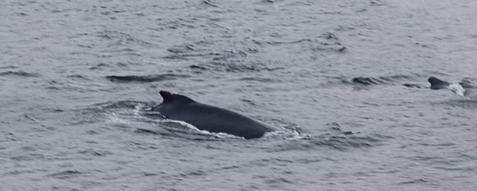
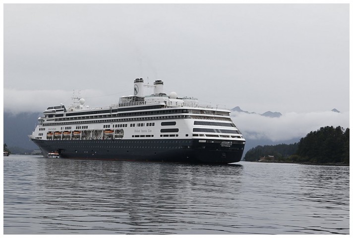
Sitka is one of the most picturesque ports of call in Alaska,; islands by the score, mountains with fresh snow on their peaks greet you as one sails in. We pass some humpback whales feeding, the krill so obviously plentiful that they’re only submerged for a few minutes. We slow down when we near the area they are feeding and watch as they surface away on our port side.
A ‘wheelie’ off the Twins and we back down to the Inner anchorage; it affords a convenient spot, near the tender pier and thus a shorter trip for guests, the outer anchorage is a good 10 minute ride longer. I go ashore, the first time for weeks and hit the pharmacy, mundane items, toothpaste and shave gel. I take my camera of course, a nice opportunity.
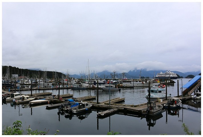
Crescent harbour, shelter from the winter storms.
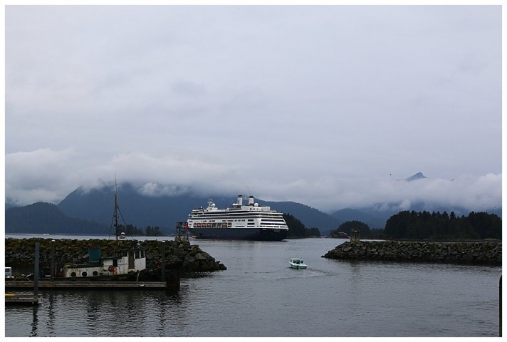
At anchor, Sitka inner anchorage.
At anchor, the view from Crescent harbour
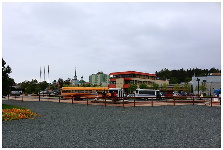
These school buses get everywhere!
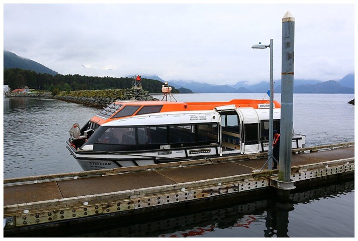
One of our tenders
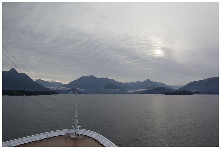
Approaching Sitka, fresh snow on the higher peaks.
